What Is Aerial LiDAR Surveying and When Should You Use It?
Aerial LiDAR surveying is a high-precision mapping method used to capture accurate 3D data of land, infrastructure, vegetation, corridors, mining areas and development sites.
Instead of relying only on traditional ground measurements or flat aerial photography, LiDAR uses laser-based scanning to measure the shape, height and surface detail of an area. When captured from an aircraft, this allows project teams to map large or complex areas quickly and accurately.
For engineering, infrastructure, energy, mining, agriculture and environmental projects, aerial LiDAR helps turn physical terrain into reliable data that can be used for planning, design, feasibility studies and decision-making.
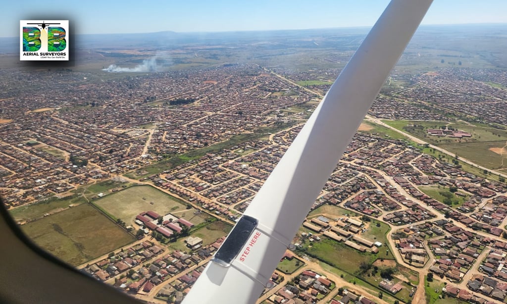
BB Aerial Surveyors provides Aerial LiDAR Surveys for infrastructure, mining, energy, agriculture and environmental projects across Southern Africa.
What does LiDAR mean?
LiDAR stands for Light Detection and Ranging.
In simple terms, LiDAR works by sending laser pulses toward the ground and measuring how long they take to return. These measurements are used to create a detailed 3D representation of the surveyed area.
The final data can show:
Ground levels
Terrain shape
Elevation changes
Vegetation height
Surface features
Infrastructure corridors
Stockpiles and volumes
Roads, routes and development areas
This makes LiDAR especially valuable when accuracy, speed and scale matter.
What is aerial LiDAR surveying?
Aerial LiDAR surveying means the LiDAR sensor is mounted on an aircraft and flown over the survey area.
This method is especially useful when the project area is:
Large
Difficult to access
Covered by vegetation
Spread across long corridors
Located in remote terrain
Time-sensitive
Too complex for only ground-based methods
For large-scale projects, aerial LiDAR can capture data faster than many traditional survey methods while still providing highly detailed mapping outputs.
When should you use aerial LiDAR?
Aerial LiDAR should be considered when a project needs accurate spatial data before planning, designing, building or making technical decisions.
You should consider aerial LiDAR when you need to:
Plan a new infrastructure route
Map a powerline, pipeline, road or rail corridor
Measure mining stockpiles or terrain volumes
Assess land before development
Understand elevation and drainage conditions
Map vegetation and ground levels
Support engineering design
Compare terrain changes over time
Reduce uncertainty before committing to a project
In many cases, LiDAR is used early in a project because better data at the start can reduce costly problems later.
Common industries that use aerial LiDAR?
Aerial LiDAR is used across many industries where accurate mapping is important.
Infrastructure and engineering?
Engineers and project teams use LiDAR data to understand terrain, levels, routes and site conditions before design or construction begins.
This can support:
Roads
Rail
Bridges
Pipelines
Water infrastructure
Sewer infrastructure
Urban development
Rural development
Energy and renewable projects?
For energy and renewable infrastructure, LiDAR is useful for mapping long routes, corridors and development areas.
It can support:
Transmission lines
Powerline corridors
Solar developments
Wind farm planning
Access road planning
Substation site assessment
Mining and volumetric surveys?
Mining operations often need accurate volume and terrain data. Aerial LiDAR can assist with:
Stockpile measurements
Pit mapping
Terrain modelling
Haul road planning
Surface change monitoring
Mine rehabilitation planning
Environmental and agricultural mapping?
LiDAR can also support environmental and agricultural decision-making by helping teams understand land, vegetation, elevation and drainage patterns.
It can support:
Environmental impact planning
Land-use assessment
Vegetation mapping
Agricultural terrain analysis
Water flow and drainage planning
Conservation and rehabilitation projects
What deliverables can come from an aerial LiDAR survey?
The exact deliverables depend on the project, but aerial LiDAR surveys can produce a range of useful mapping outputs.
These may include:
Point cloud data
Digital terrain models
Digital surface models
Contour data
Orthophotos
3D mapping outputs
Corridor mapping data
Volumetric calculations
GIS-ready datasets
Engineering-grade survey outputs
These deliverables help technical teams work from accurate spatial information instead of assumptions.
Why aerial LiDAR is valuable for project planning?
The biggest value of aerial LiDAR is that it helps project teams make better decisions earlier.
With accurate survey data, teams can:
Reduce project uncertainty
Identify risks sooner
Improve route and site planning
Support design decisions
Reduce unnecessary site visits
Improve reporting and documentation
Work from one reliable data source
Save time on large or difficult survey areas
For projects where terrain, elevation, distance or access are important, LiDAR can become a critical planning tool.
When to use aerial LiDAR vs drone surveying?
Both aerial LiDAR and drone surveying can be useful, but they are not always used for the same type of project.
Drone surveys are often useful for smaller areas, visual inspections and site-specific mapping.
Fixed-wing aerial LiDAR is better suited to:
Larger areas
Long-distance corridors
Regional mapping
Remote terrain
Large infrastructure projects
Projects that require speed and scale
The right method depends on the size of the area, the required accuracy, the terrain, the timeline and the final deliverables needed.
When should you speak to a LiDAR survey provider?
You should speak to a LiDAR survey provider when your team needs accurate mapping data before making technical, design or investment decisions.
This is especially important when:
The area is large or complex
Existing maps are outdated
Ground access is difficult
The project has engineering requirements
Accurate levels or terrain models are needed
Route or corridor decisions must be made
You need data that can be used by engineers, planners or GIS teams
The earlier this conversation happens, the easier it is to define the right survey method and deliverables.
Frequently Asked Questions
What is aerial LiDAR used for?
Aerial LiDAR is used to create accurate 3D mapping data for infrastructure, energy, mining, environmental, agricultural and development projects.
Is LiDAR better than normal aerial photography?
LiDAR and aerial photography serve different purposes. Aerial photography provides visual detail, while LiDAR provides accurate 3D measurement data. Many projects benefit from using both.
Can LiDAR be used for mining stockpile measurements?
Yes. LiDAR can be used to capture surface data that supports stockpile volume calculations, terrain modelling and mine planning.
Can LiDAR map through vegetation?
LiDAR can often capture ground information beneath vegetation better than standard imagery, depending on vegetation density and project conditions.
Is aerial LiDAR suitable for powerline and pipeline corridors?
Yes. Aerial LiDAR is well suited to long corridor mapping projects such as powerlines, pipelines, roads and rail routes.
What information is needed before requesting a LiDAR quote?
Useful information includes the project location, approximate area size, required deliverables, accuracy requirements, timeline and intended use of the data.
Need accurate survey data for your next project?
BB Aerial Surveyors provides fixed-wing LiDAR and aerial mapping solutions for infrastructure, energy, mining, agriculture and environmental projects across Southern Africa.
If your project needs accurate terrain, corridor, volumetric or mapping data, contact BB Aerial Surveyors to discuss the right survey approach.
Contact BB Aerial Surveyors to discuss your aerial LiDAR survey requirements.
Contact Us
info@bbaerialsurveyors.co.za
+27-82-852-4309
© 2026 BB Aerial Surveys (Pty) Ltd. All Rights Reserved | Website designed and developed by Creative Co-Pilot — Guiding brands from idea to launch, and beyond.
LiDAR You Can Build On
Serving South Africa & Pan-Africa
Build Smarter With LiDAR
Get expert LiDAR updates, case studies, and project insights straight to your inbox.